This website uses cookies so that we can provide you with the best user experience possible. Cookie information is stored in your browser and performs functions such as recognising you when you return to our website and helping our team to understand which sections of the website you find most interesting and useful.
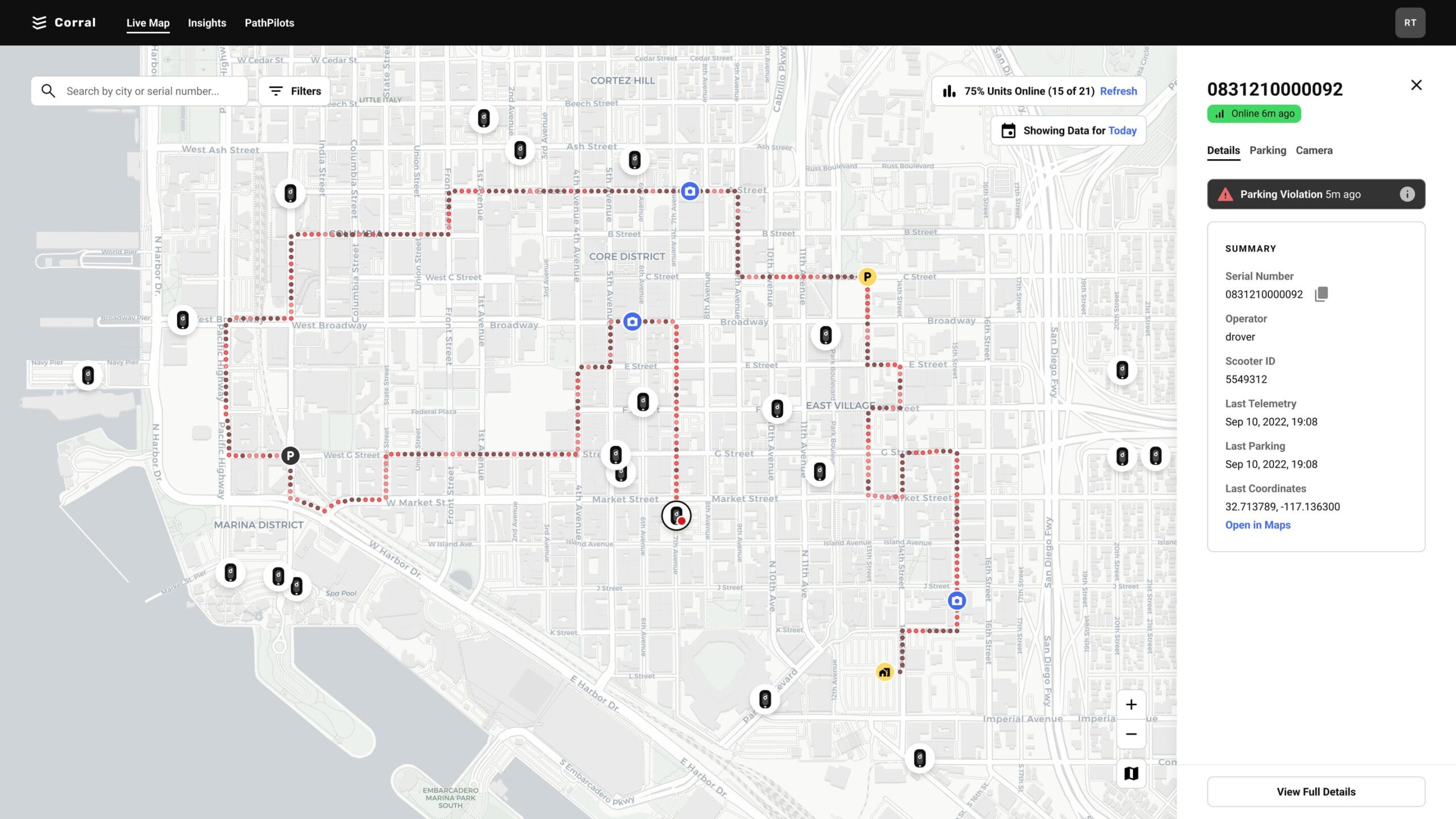
Individual trips are mapped and color coded to identify the unique infrastructure used along the journey and at the end of the ride.


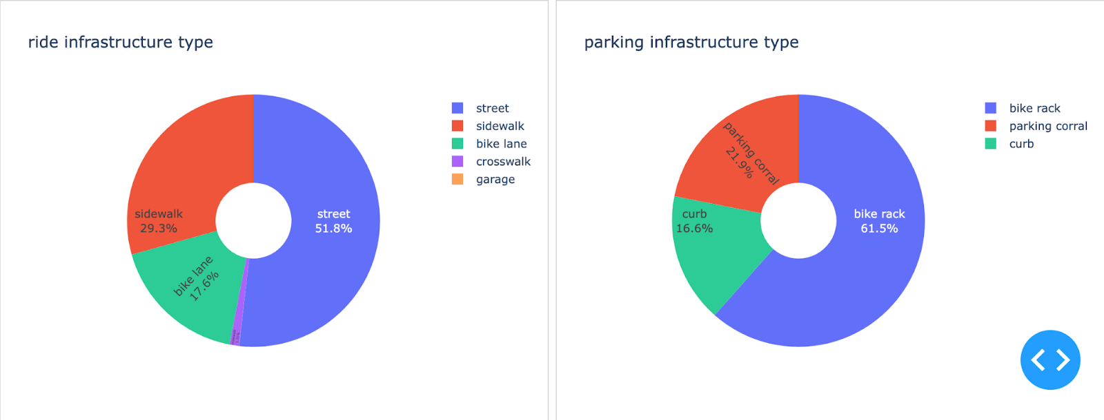
Similarly, data is compiled across multiple devices or entire fleets in various geographies to show aggregate behavior.

Drover’s data insights are powerful tools to help operator market managers run their fleets more efficiently, cities understand how their infrastructure is used, and also provide insurance companies with unprecedented understanding of risk in the industry.
Corral Features
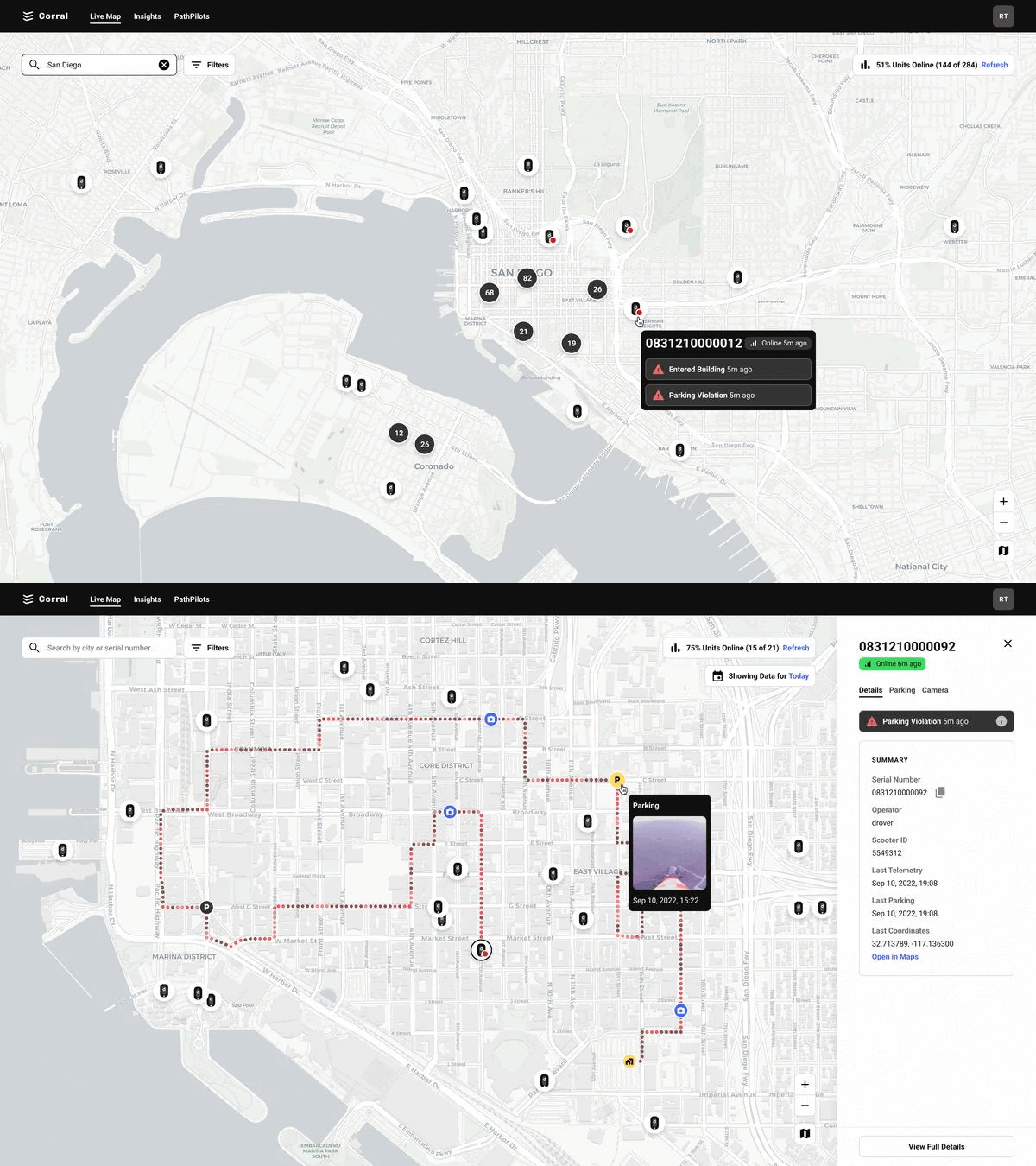
- Identify and locate deployed PathPilot & PathPilot Lite units
- View trip and aggregate telemetry
- View individual end of ride parking events with photos
- View historic telemetry and parking instances on each unit
- Receive incident alerts - parking structure entered, scooter tipped over, vehicle accident
